
Drone Surveys
Drone Surveys: Survey Your Sites Up To 5x Faster

What We Do
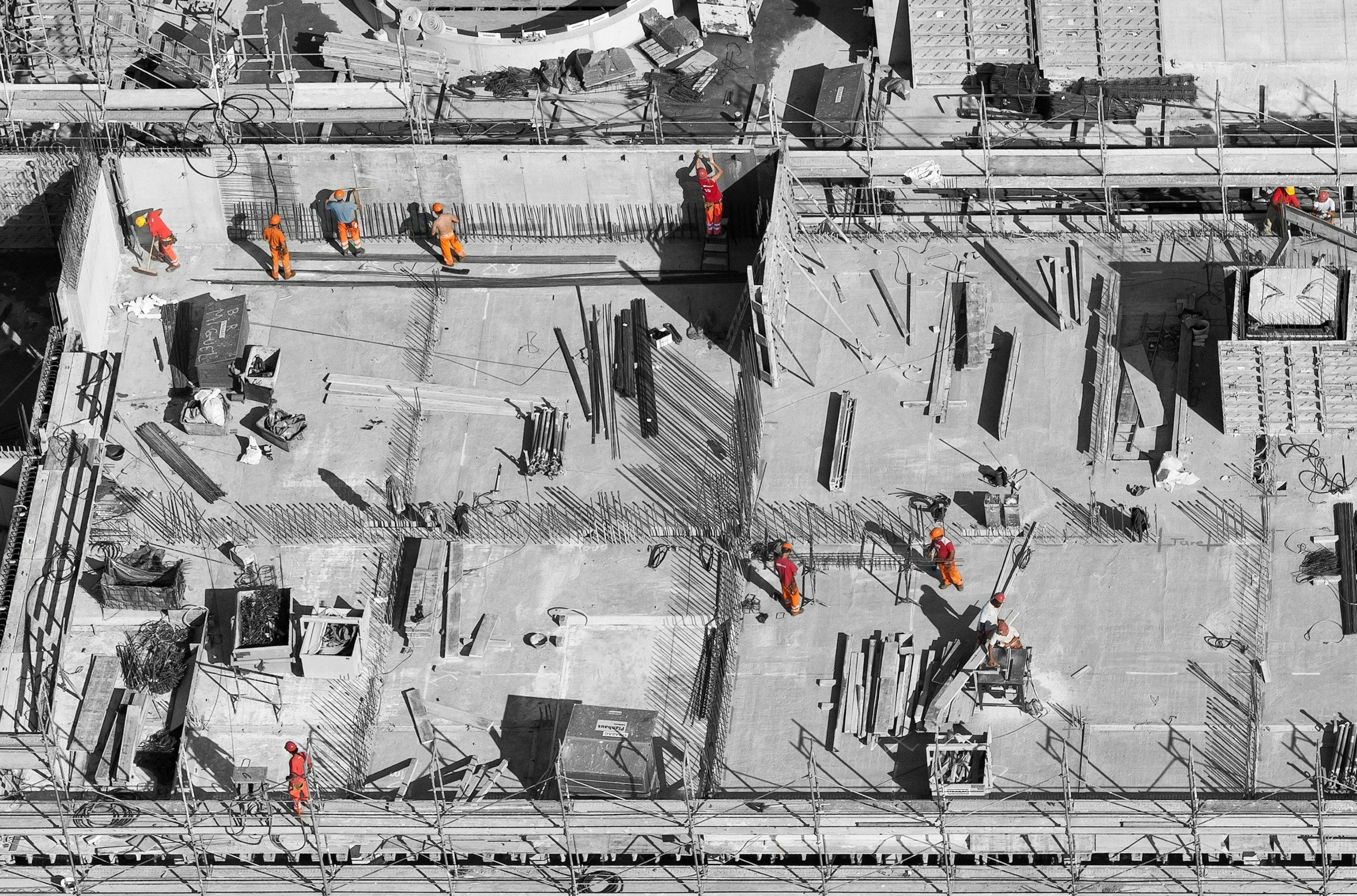
We offer a comprehensive range of drone survey services, including photogrammetry, LiDAR, infrastructure inspection, and aerial photography and videography.
Our drones are equipped with high-resolution cameras and sensors capable of capturing detailed imagery, video footage, and spatial data across a wide variety of environments and structures.
Common applications include:
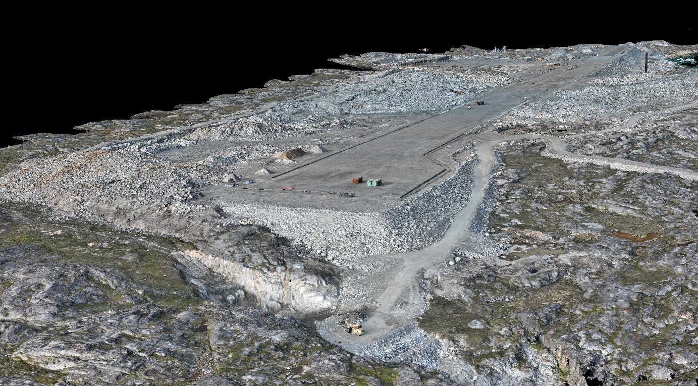
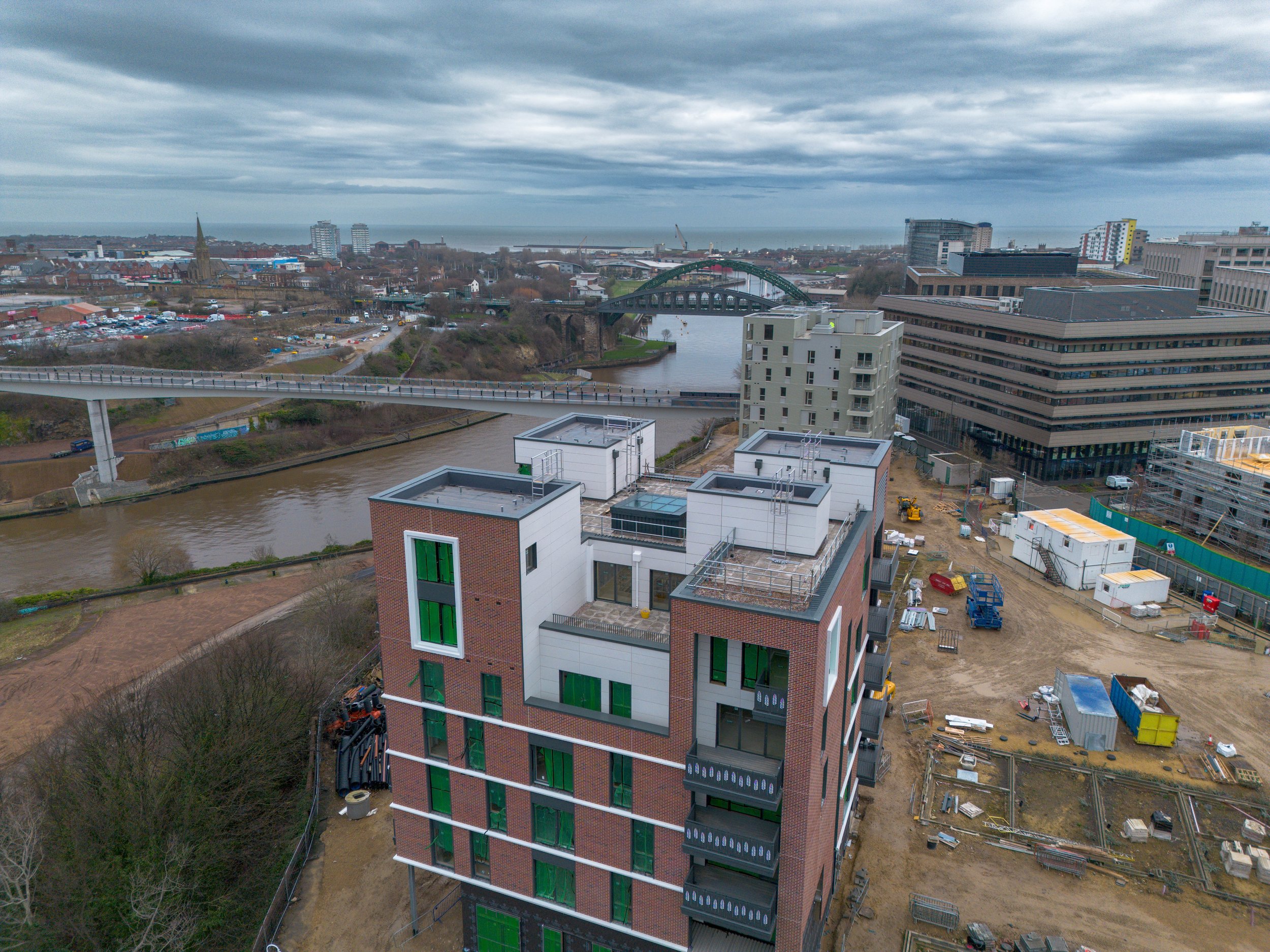
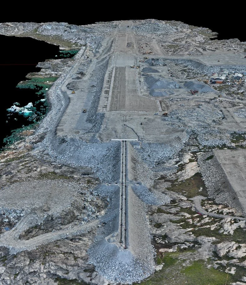
Monitoring construction progress across a programme
Assessing site conditions ahead of design or planning work
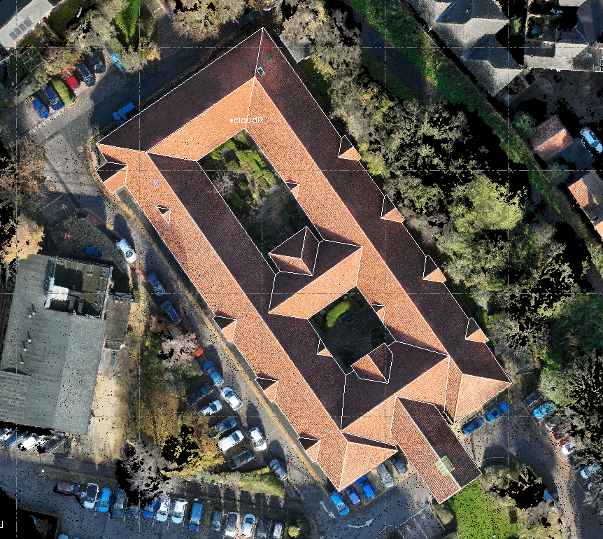
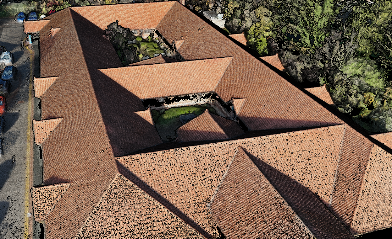
Creating 3D models for use in design, planning, or stakeholder engagement
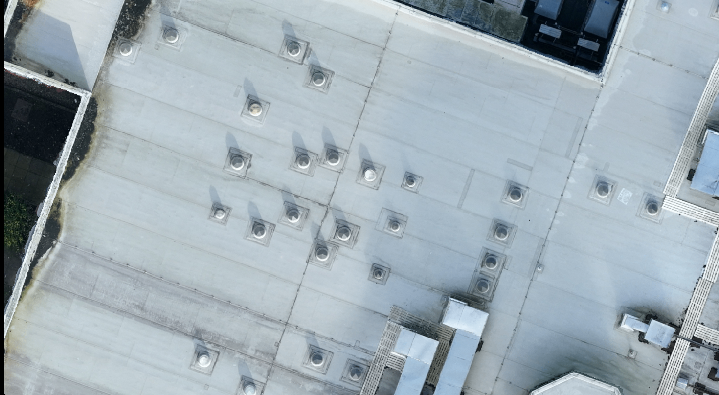
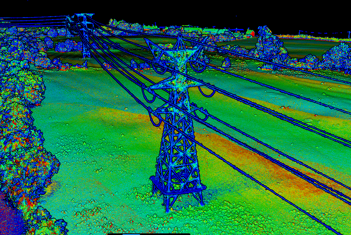
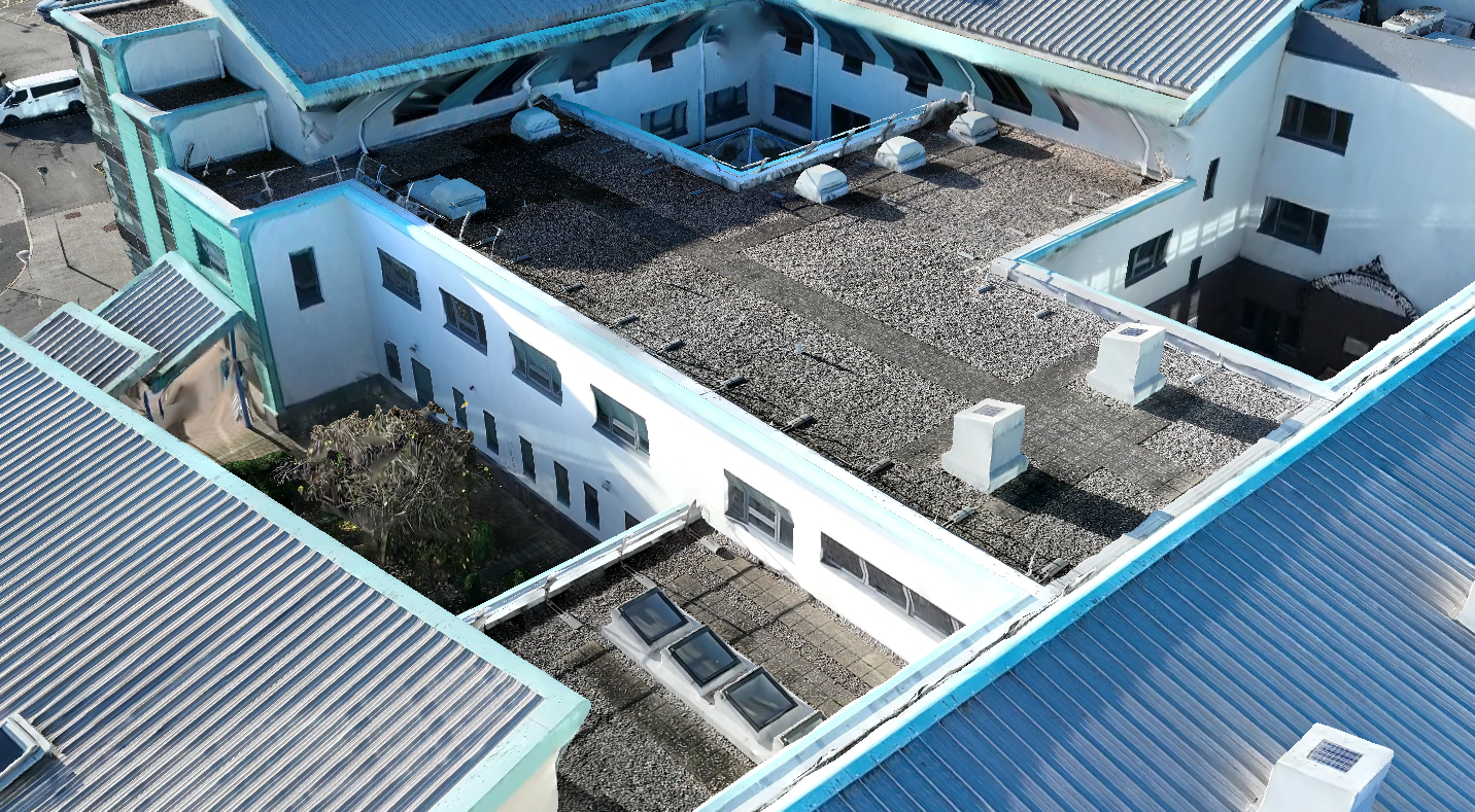
Inspecting bridges, pipelines, power lines, heritage buildings, or other infrastructure
Assessing damage in the aftermath of floods, storms, or other events
What You Receive
Following a drone survey, all raw data are processed in specialist software to produce a range of professional deliverables. Every output is fully interoperable with CAD and GIS packages.
Standard deliverables include:
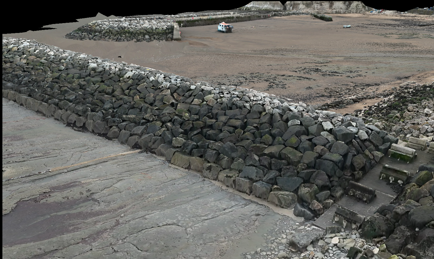
Colourised and classified point clouds
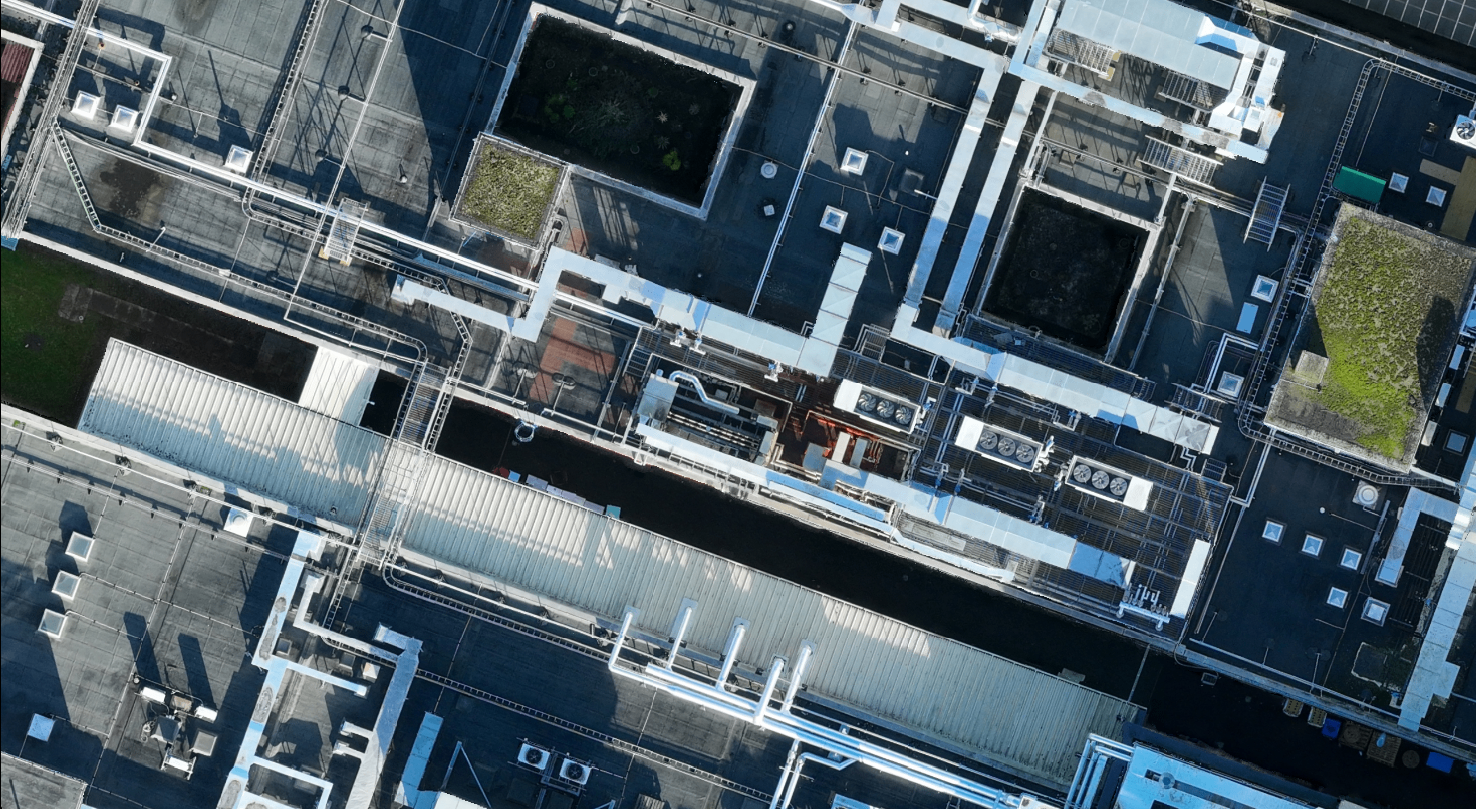
Orthomosaic imagery
Digital Elevation Models (DEMs)
3D built environment models and flythroughs
Volumetric and stockpile calculations
High-resolution imagery and video footage
This list in not exhaustive – deliverables can be tailored to the requirements of each project.
At Latitude Geospatial, our drone survey team are fully qualified pilots, operating in full compliance with the Civil Aviation Authority (CAA) under General Visual Line of Sight (GVC) certification, and European Union Aviation Safety Agency (EASA) under Open A2 regulations for Remotely Piloted Aircraft Systems.
Whether you are managing a large construction programme, maintaining critical infrastructure, or monitoring land over time, our drone surveys give you the accurate, reliable data you need - collected faster and more safely than traditional methods alone.
Why Choose Our Drone Surveys?
Drones have changed the way data are collected. What once took days of ground-based fieldwork can now be completed in a matter of hours, without placing personnel in unnecessary or hazardous situations.
Our award-winning services offer clear benefits across every project type:
Faster Data Collection: Reduced time on site significantly without sacrificing accuracy.
Improved Safety: Keeping our team away from hazardous or difficult-to-reach areas reduce risk exposure.
Repeatable Surveys: Ideal for tracking progress across the full lifecycle of a project.
Virtual Site Models: Detailed 3D environments that allow stakeholders to explore a site without setting foot on it.
Access To Restricted Areas: From telecommunications masts and high-rise structures to confined or unsafe terrain, our drones reach where people cannot.
High-Accuracy Geospatial Data: Precise, survey-grade datasets compatible with industry-standard CAD and GIS software.
With hundreds of flying hours behind us and an award-winning record for accuracy, we are well placed to support your next project.
Whether you need a one-off site surveyor ongoing monitoring across a long-term programme, our team if ready to discuss your requirements.


Commissioning a Drone Survey?
Complete the form to get your FREE client checklist.


Drone Data Processing
Already collecting drone data in-house?
If your organisation captures its own drone data but lacks the capacity or specialist software to turn that raw data into usable outputs, we can help. Our processing team works with data collected by others and produces professional 2D and 3D models to the same standards as our own surveys.
No project is too large or too small. We can also provide guidance on how to improve your existing drone survey workflows.
Trusted partners:


Testimonials
Request A Drone Survey
-
UK CAA regulations stipulate that drones can fly at a maximum altitude of 400ft (120m) above ground level. They must also be operated within Visual Line of Sight (VLOS) at all times, up to a maximum distance of 500m from the remote pilot.
-
Accuracy depends on the technology used. Modern enterprise drones typically achieve 2-5cm when coupled with ground control points (GCPs) and check points (CPs).
-
Legally you do not need your neighbour’s permission to fly over their property, provided that drone is flown within the laws and regulations laid down by the CAA. You must comply with GDPR and Privacy Laws, however. It is best-practice to inform all land-owners of your intended flight mission.
-
This is dependent on the type of survey you have commissioned. High resolution images and videos are common for roof inspections whilst orthomosaics, point clouds, and digital elevation models (DEM) are common for topographic surveys.
-
For topographic surveying, a 4 hectare site can be surveyed in under 30 minutes. However, the “work” is in the processing. 3D models and CAD/GIS deliverables can take up to 3-5 days to generate.